Real locations
Lochaber and the Great Glen
...a narrow stone structure whose elevation above the river-bed had earned
it the name of High Bridge.
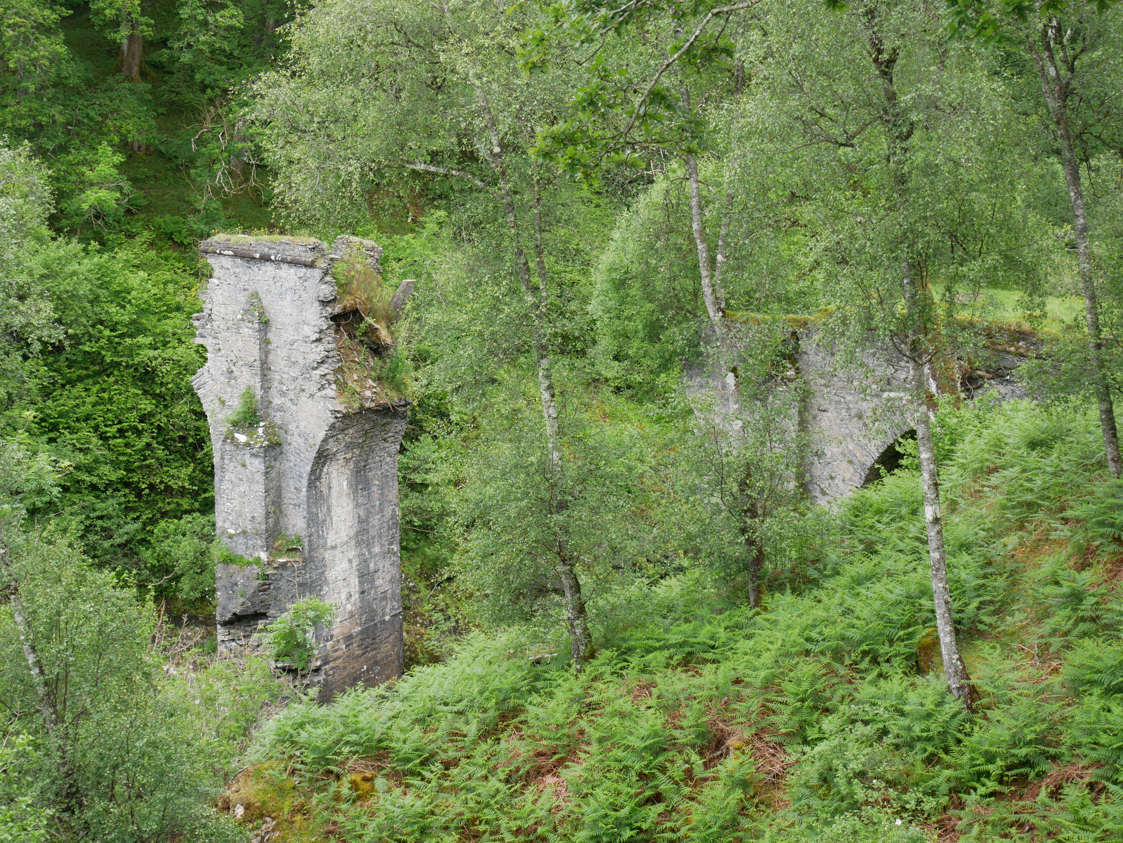
Here is High Bridge, which is indeed well-named! Although it’s a ruin today, it survived
for a fairly long time after the period of Flight of the Heron; Wikipedia
has a photo of it
still intact in 1899. The modern-day footpath leading to the bridge follows the route of
Wade’s road for a little way on the eastern side of the Spean. Between the oblique angle
at which the road approaches the river, the woodland cover and the steep banks, you really
can’t see the bridge at all until you’re almost upon it; those
‘eleven men and a piper!’ chose the place for their ambush well.
The next obstacle was a river, which he had to cross as best he could
on insecure and slippery stones, and the difficulties of doing this with an injured
ankle took his mind off remoter possibilities...
This is the River Garry, which Keith crosses in chapter 1.1, near where it flows into
Loch Oich. Crossing on foot with an injured ankle would certainly present serious
difficulties—I’m impressed at Keith’s feat!
Keith Windham looked for cover, but here there was none convenient
as a while ago...

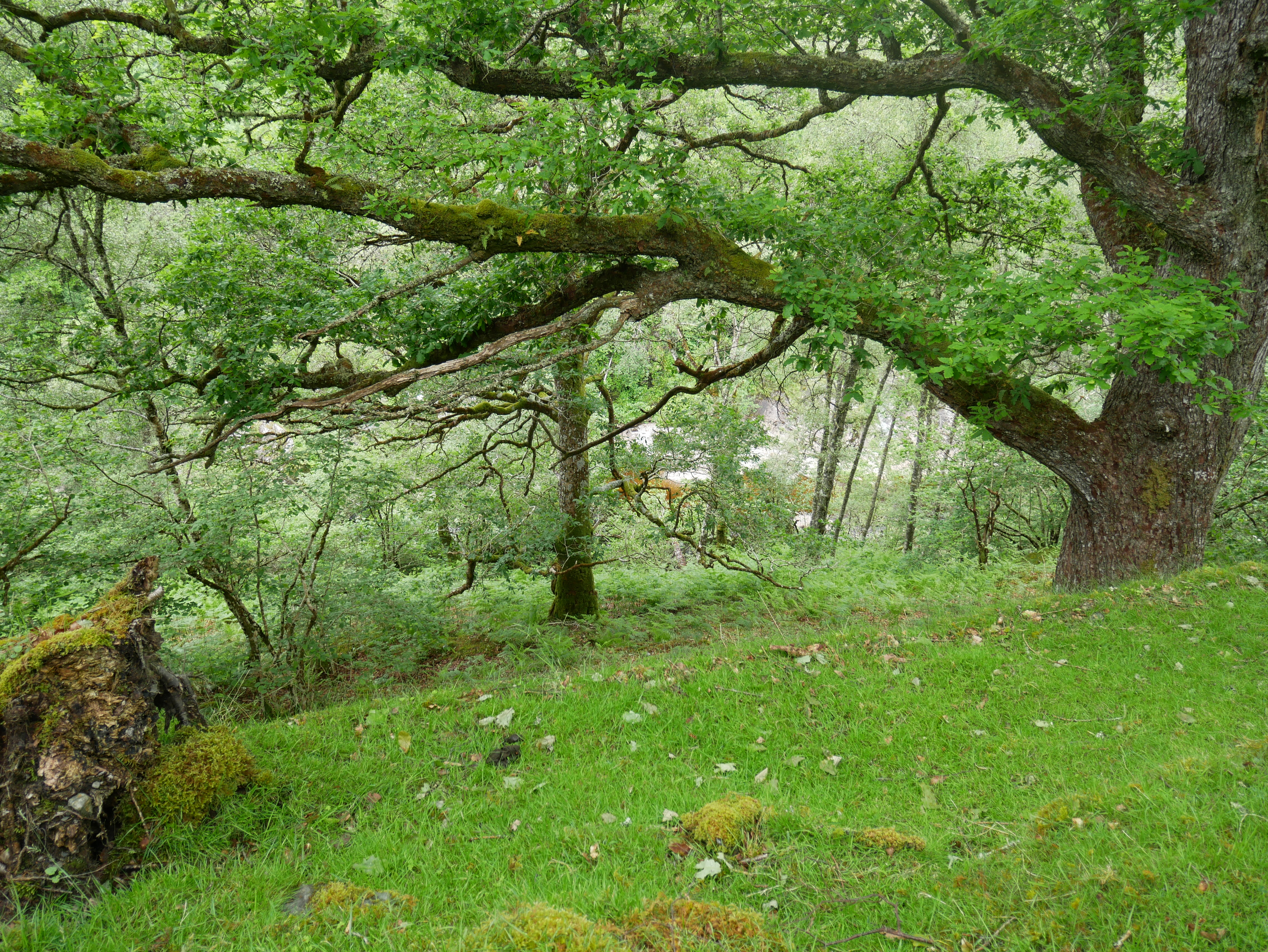
Loch Oich side, northeast of the River Garry; near the site of Ewen and Keith’s first
meeting. The area is now covered with spruce and other trees, so we must imagine what
it would look like with more open ground:
... on the stretch of level ground at the head of Loch Shiel, among that
wild and lonely scenery, a thousand Highland throats acclaimed the fair-haired young
man standing below the folds of his banner, and the very air seemed to flash with the
glitter of their drawn blades.
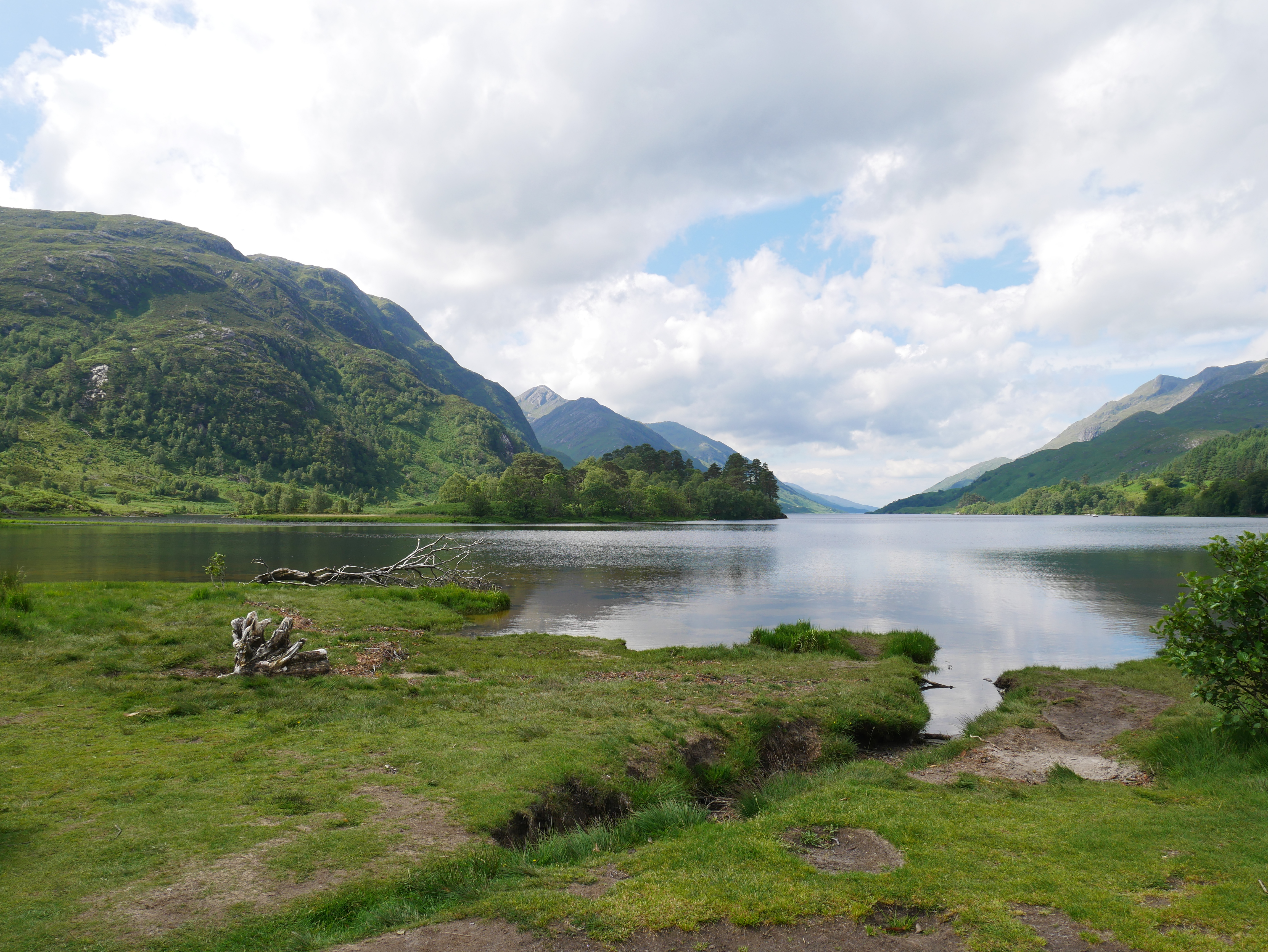
The view along Loch Shiel at Glenfinnan. I hardly need to say that it’s very picturesque
and romantical indeed; Charles Edward Stuart certainly knew how to choose his scene.
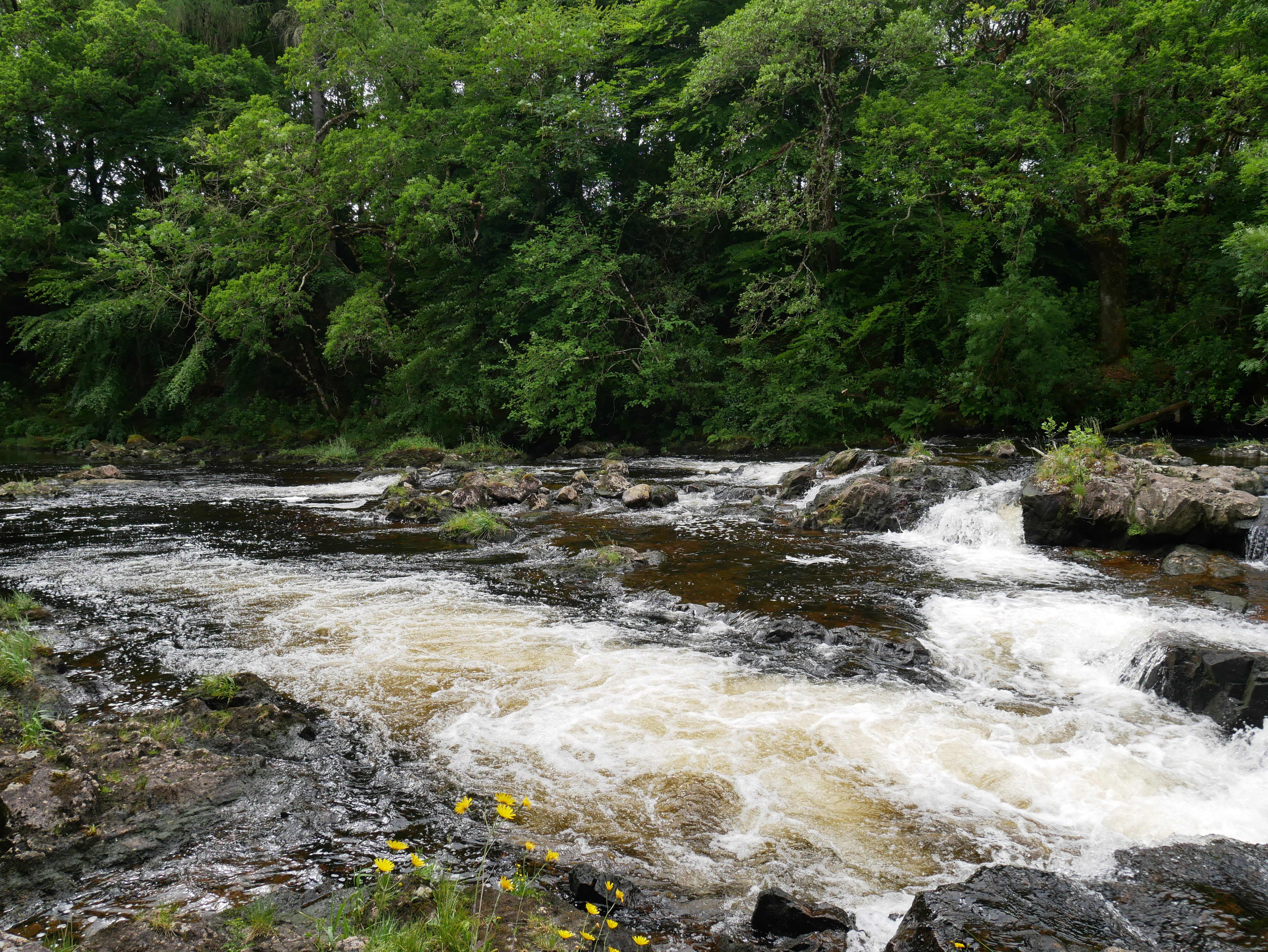
...Ewen cut away the trailing rope from his other ankle, pocketed it,
and started to plunge on as fast as he could among the birch and rowan trees, the
moss-covered stones and the undergrowth of Spean side.
The banks of the Spean, a little way downstream from High Bridge, where Ewen hides
after escaping from the troopers in chapter 5.1. It’s seriously precipitous, and
would definitely be an effective place to hide!
And there he had seen the pitiful charred remains left by vengeance
of Lochiel’s house of Achnacarry, almost as dear to him as his own.

This is all that now remains of the old Achnacarry House, burned down by Government
soldiers in 1746: a very well-ivied chimney piece. It stands in the grounds of the
new house near Loch Arkaig, where the present Lochiel still lives and where the
Clan Cameron Museum—very well worth a visit—is located.
Edinburgh
For Prince Charles and his Highlanders held the town, but not the Castle,
secure on its lofty and impregnable rock...

Edinburgh Castle looming on its rock above the Old Town. Photo by Kim Traynor via
Wikimedia Commons.
But at the other end of the town Holyrood House was lit up, for there was
dancing to-night in the long gallery under the eyes of that unprepossessing series of
early Scottish kings due to the brush of an ill-inspired Dutchman . . . and under a
pair of much more sparkling ones. For the Prince was gay to-night...

Holyroodhouse Palace, where Charles Edward Stuart held court during the ’45. Photo by
Alli Caulfield, via Wikimedia Commons.

The Great Gallery at Holyroodhouse Palace, the scene of the ball in chapter 2.1.
The paintings are a series of portraits of Scottish monarchs made by Dutch
painter Jacob de Wet upon the orders of Charles II. Photo by Otto Domes, via
Wikimedia Commons.
...an old lady, but no doubt charming, and certainly loyal—who dwells at
the corner of the West Bow and the Grassmarket.”

The house at the corner of the West Bow and the Grassmarket. Since that description
is fairly precise, and at least part of this house is certainly old enough to have
been there in 1745, I can say with some confidence that this is Lady Easterhall’s house,
where Ewen and Keith have their second meeting in Part II.
“The entrance, however, is neither here nor in the West Bow, but up a
close leading out of the Grassmarket, so Murray says.”
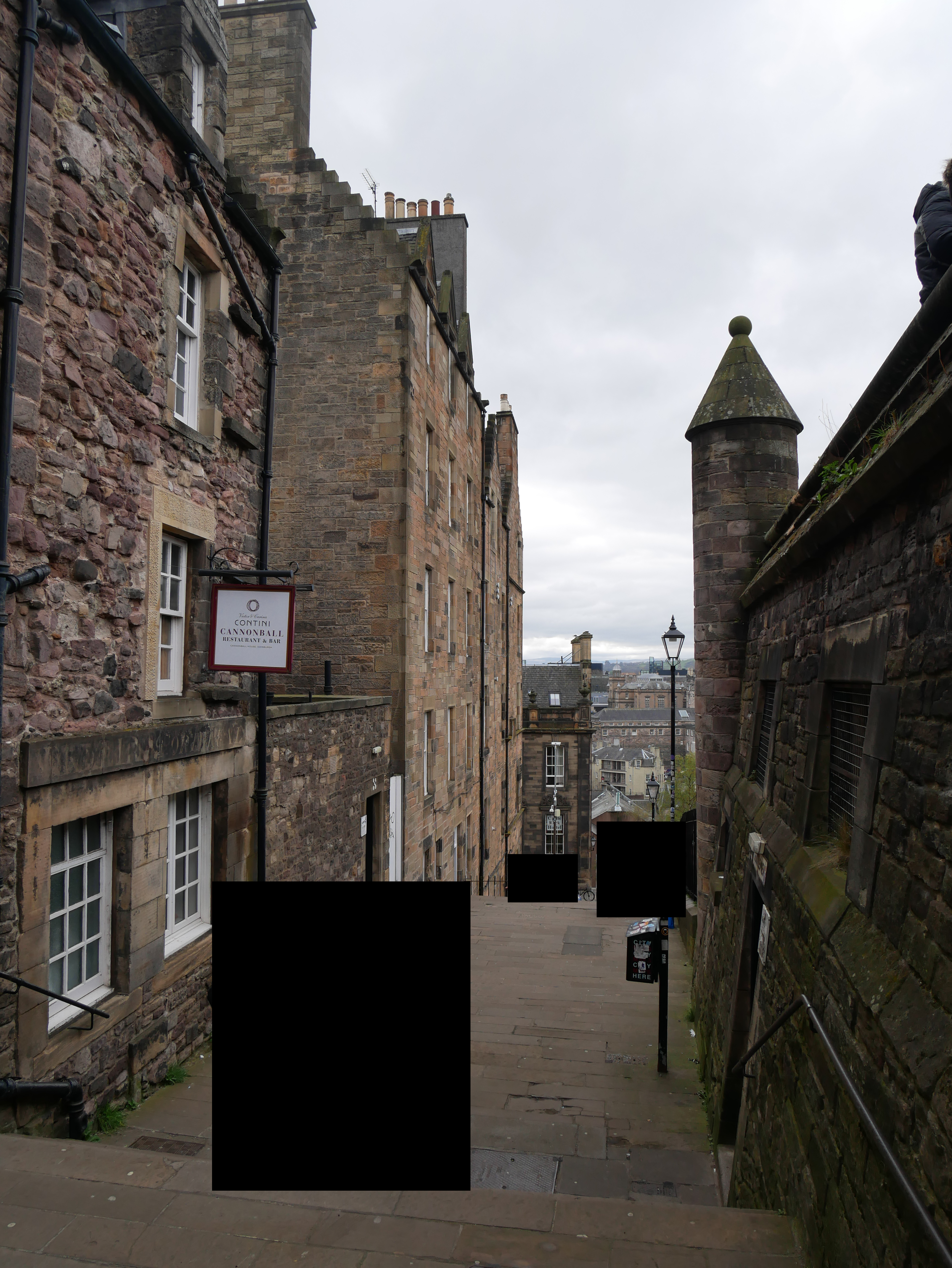
As can be seen in the photo above, there’s no such close immediately on the
other side of the real house. But there is a real close, Castle Wynd,
which as its name suggests leads from Castle Hill down onto the Grassmarket; it’s
a bit further along in real life, and I think Broster moved it eastwards towards
the house in service of her plot. This photo shows the northern part of Castle
Wynd leading down from Castle Hill; it’s pretty steep, with a lot of stairs!
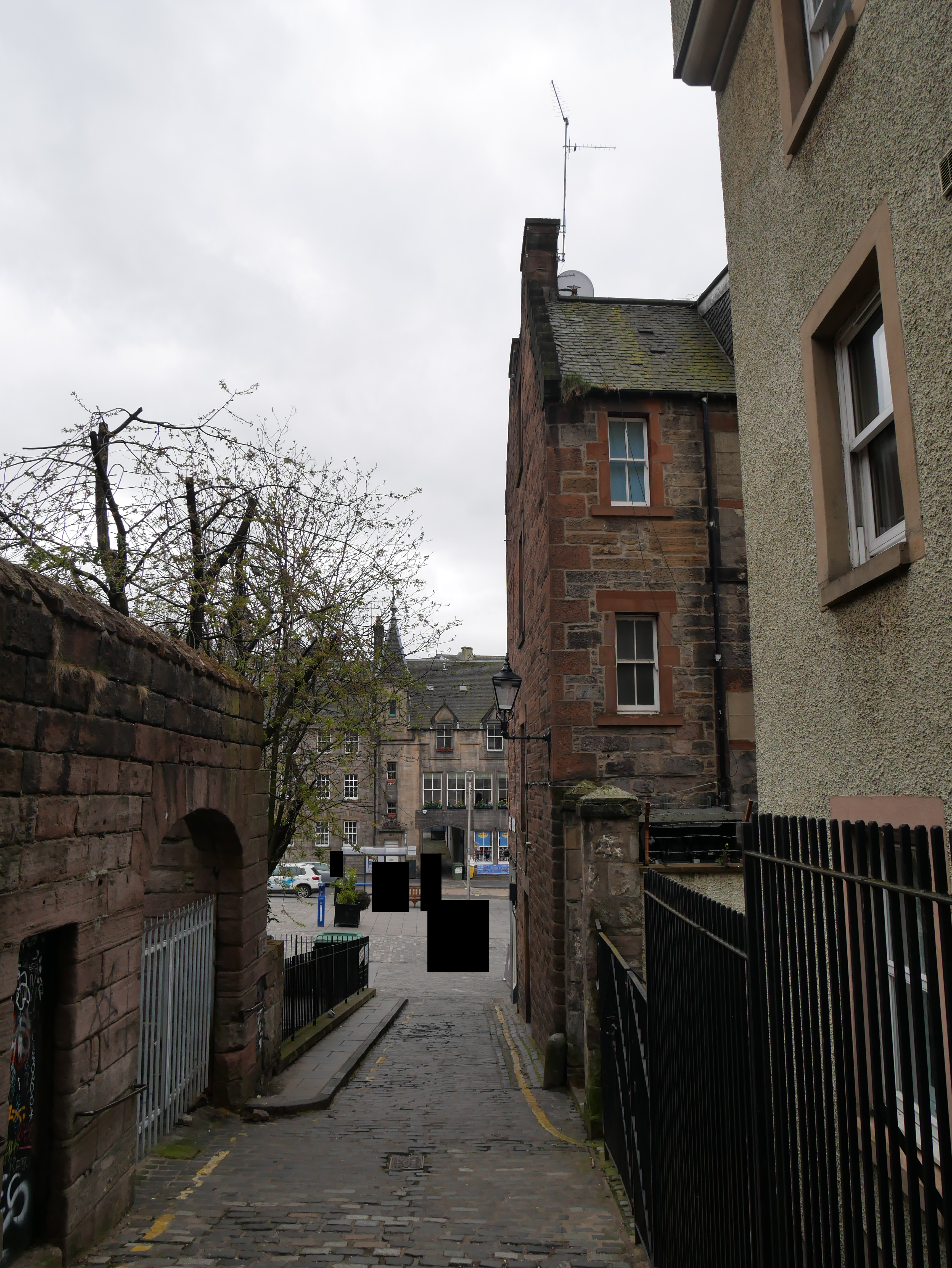
Here is the southern part of Castle Wynd, showing its egress onto the
Grassmarket:
Morar
The descriptions of Morar Bay in chapter 5.5 are precise and largely accurate,
and as with much of the rest of the book Keith’s movements can be followed on a map.
Here are some pictures of the scene.
Quartered himself at Arisaig, he thence patrolled the coast in both
directions, from Loch nan Uamh, the Adventurer’s original landing-place, to Morar
of the white sands on the other...

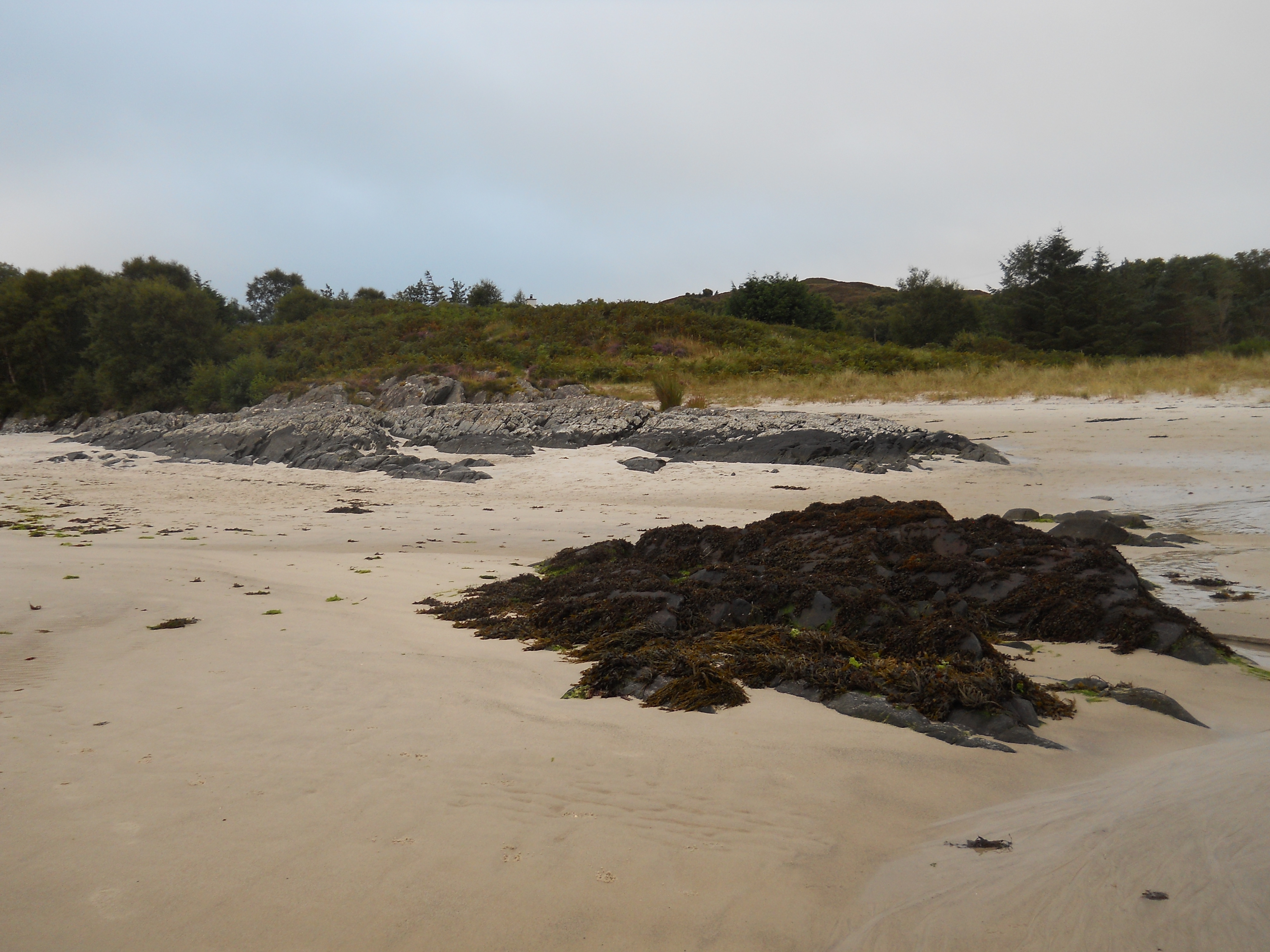
The beach at Morar, with white sand. Photo by Luzula.
Keith gave his horse to his orderly, and going along a low spur of rock
gazed steadily out to sea.
A possible candidate for the ‘low spur of rock’. The features on the ground
don’t perfectly match Broster’s descriptions; possibly, as with the wynd in Edinburgh,
she moved different parts of the beach closer together for narrative convenience.
Photo by Hyarrowen.
Once more he plunged down the sandy slope [...] He looked round for shelter,
and slipped cautiously into a high bush of hazel which itself stood in a patch of
shadow so deep that he felt sure of being invisible.
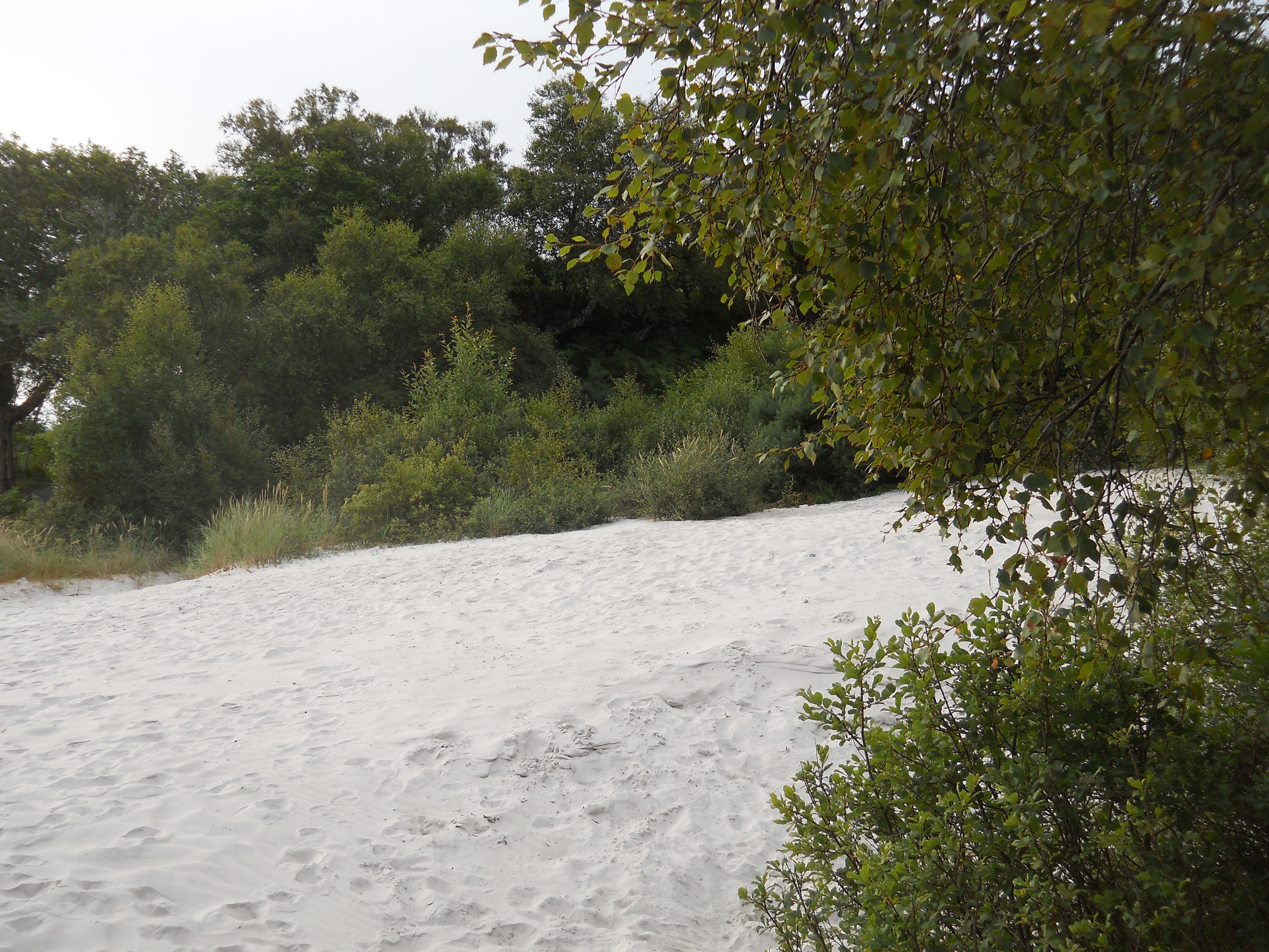
A sandy slope with sheltering trees above the beach, further inland towards the
river; one possible location for the fatal spot itself. Photo by Hyarrowen.
Fictional locations
You’ll note that the map above helpfully informs the reader that ‘Two sites on this map
are fictitious’. These are 1) the glen of Ardroy and Loch na h-Iolaire and 2) Beinn
Laoigh or Ben Loy; with or without the map, it's possible to work out their locations
fairly precisely from the text of the book.
Ardroy and Loch na h-Iolaire
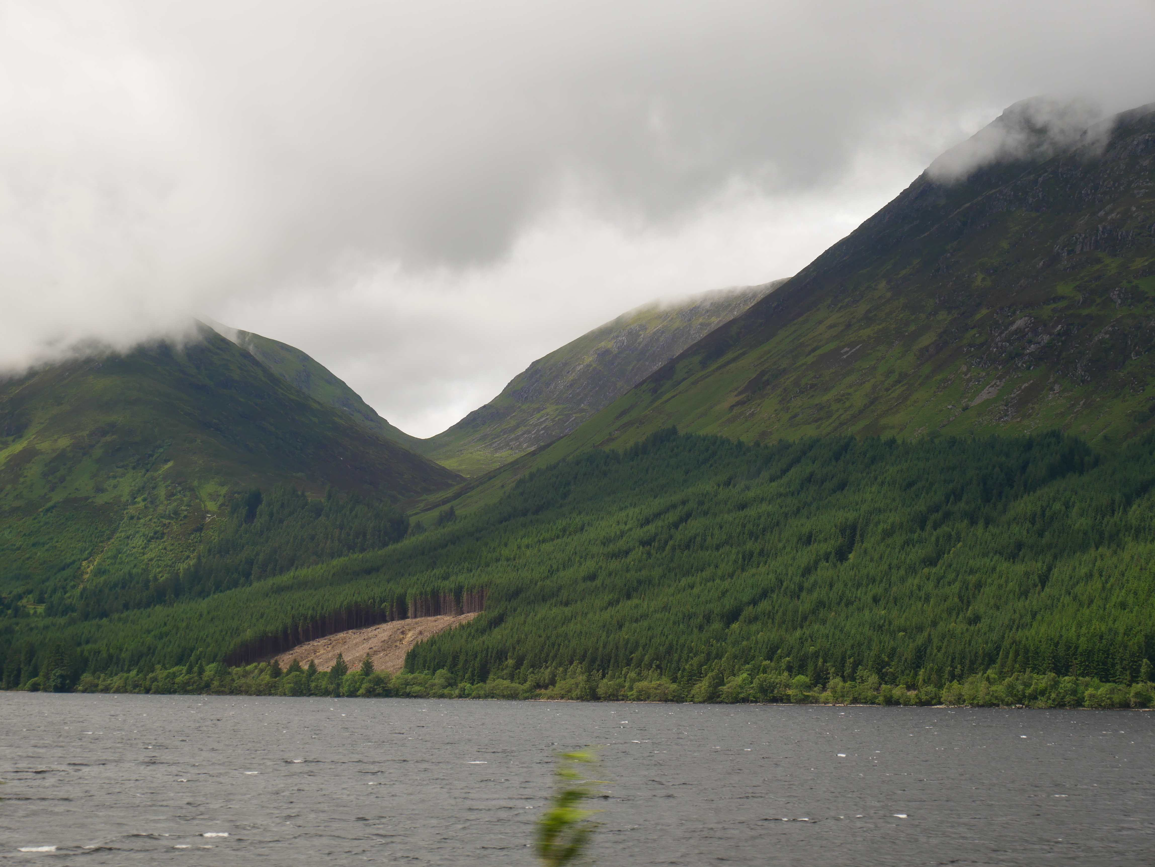
The glen of Ardroy corresponds to a real small glen in between Glengarry and Lochiel’s lands around Loch Arkaig. The narrow pass in the southeast, which leads up from the side of Loch Lochy along the course of the Allt Glas-Dhoire burn, is where Ewen brings Keith in chapter 1.2 after taking him captive.
The pass viewed from across Loch Lochy:
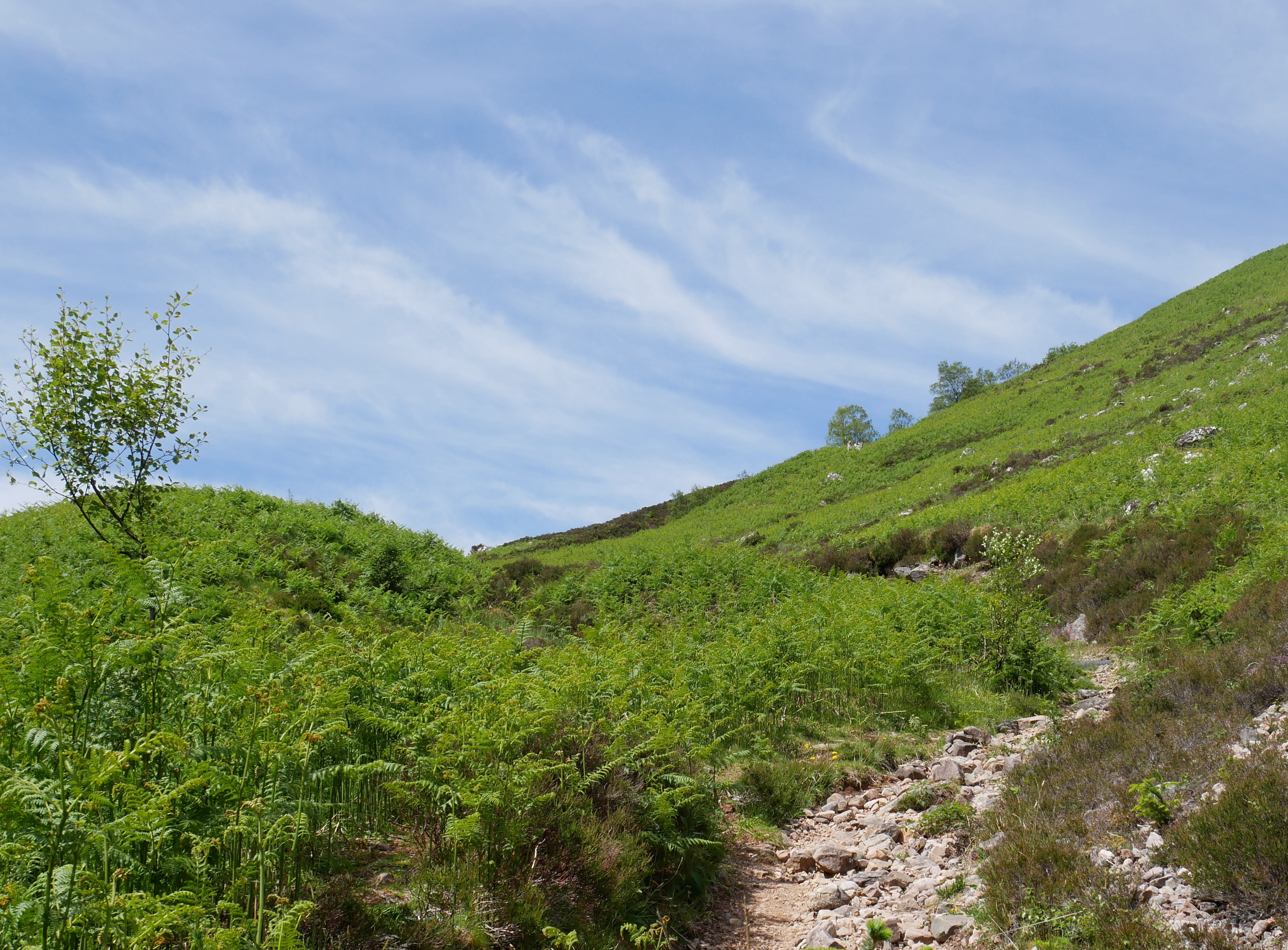
Ascending the pass:
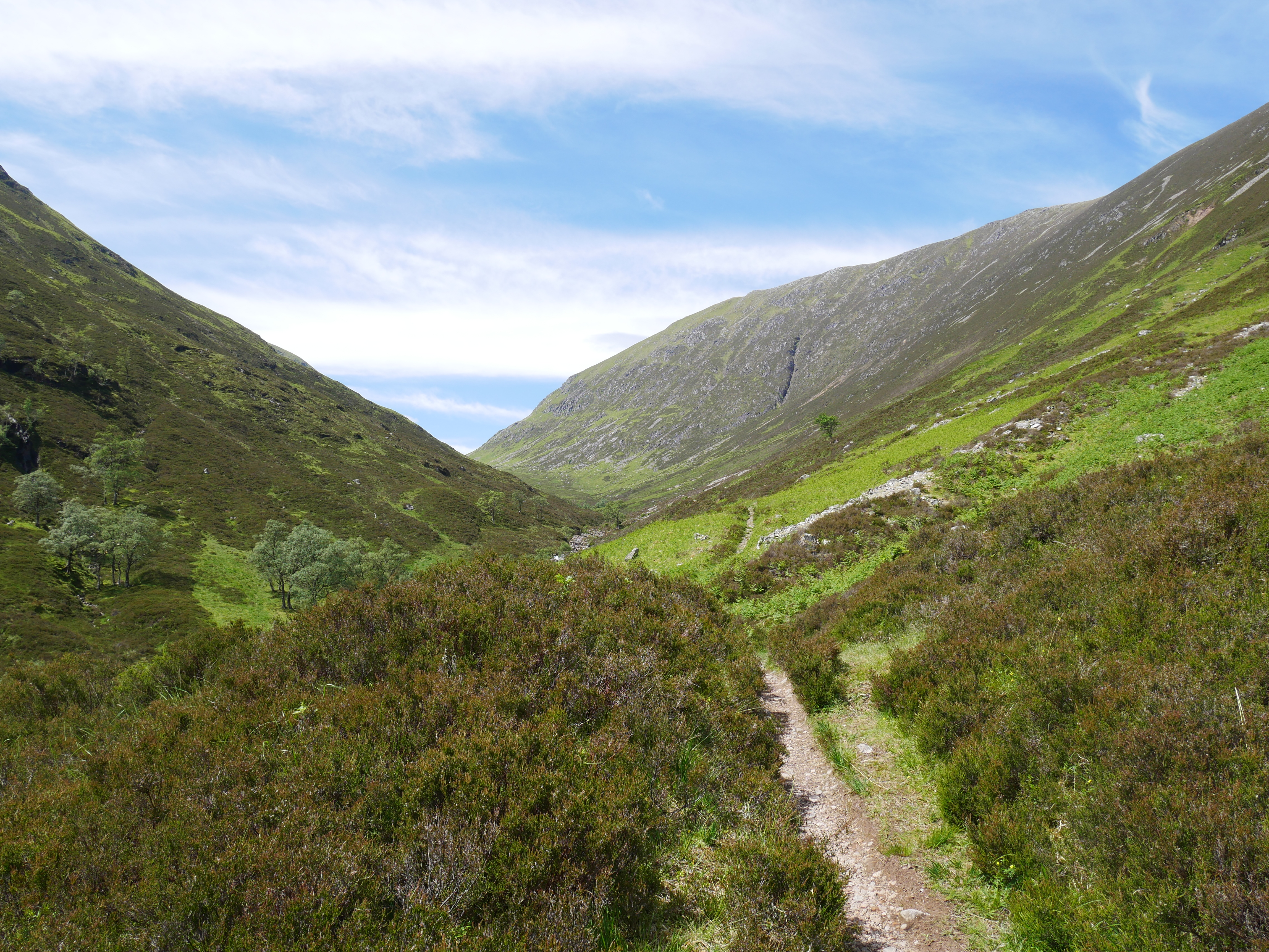
When Ewen and Keith reach the top of the pass they head westwards, ‘in the face of
the sunset afterglow’, and the house of Ardroy is in front of them; they then
‘skirt the end of the little lake’ to reach it, suggesting that the house is in
the southwest corner of the glen. Ewen apologises for the steepness of the route, saying
that he wouldn’t normally come that way; there is an easier route from the southwest up
from Achnacarry along Gleann Cia-aig, which is presumably Ewen’s usual route. Here is
Ewen and Keith's view from the top of the pass:
In the foreground is the course of the Allt Càm Bhealaich burn; Gleann Cia-aig runs
off into the far left-hand corner, with the river Abhainn Chia-aig visible in the
distance.
Loch na h-Iolaire is ‘little more than a mile long, and ... a quarter of a mile
wide’ and ‘set in a level space as wide as itself’. The shape of the real
glen suggests that the loch runs roughly north-south between Meall an Tagraidh and Sròn
a Choire Ghairbh, where it would fit quite neatly into the relatively flat area; you
can imagine its southern end fitting into the picture above. It could be an extension
of the real but much smaller Lochan Fhùdair. Although it apparently extends north-south,
Loch na h-Iolaire has a northern shore (where Lachlan stands in the prologue); I would
guess that its direction is angled slightly northwest-southeast so that the northern
part of the eastern side, or perhaps the northeast corner, could
be called the northern shore. The creag ruadh is on the (north-)eastern bank somewhere
near the middle (it’s on the same side of the loch that Lachlan is standing in the prologue;
later, Ewen and Alison sit ‘[b]etween the red crag and the
spot where he had rated his foster-brother that morning’, and Ben Tee is behind them).
In chapter 5.2 Ewen travels to Ardroy from Achnacarry, via Gleann Cia-aig. He reaches
‘the spot where, after crossing the Allt Buidhe burn, one used to discern the
chimneys of the house of Ardroy between the pines of the avenue’. This is the
clearest description of the (fictional) Allt Buidhe burn, which is probably a tributary
of Abhainn Chia-aig; it may have the same course as the real Allt Coire Odhar Beag,
which flows from east to west across the southern end of the glen, or it might flow
out of the loch to join Abhainn Chia-aig. Since this is apparently the main route to
Ardroy, the pine avenue probably points southwest along the road to Achnacarry.
Slochd nan Eun, home of the MacMartins, is in the hills near Ardroy. In chapter
1.3 Keith goes ‘along the bank of the loch’ and ‘follow[s] the path round
to the far side’, before following another path ‘away from the loch’.
With the house in the southwest corner, ‘the far side’ is presumably the eastern
shore, which puts Slochd nan Eun east or perhaps northeast of the loch.
Of course the Camerons of Ardroy are fictional, so what was the position of this
piece of land in real history? A 1770s map of the Lochiel estate on display in
the Clan Cameron museum at Achnacarry, while it does not show the area directly, states
that ‘All the Lands on this [the northern] Side of the Loch [Loch Arkaig] belong
to the Estate of Lochiel. March with Glen Gary’. ‘Ardroy’, then, was probably
part of Lochiel’s own lands in real history rather than belonging to a Cameron sept.
Glengarry, while it appears under its own name in The Flight of the
Heron, is fictionalised as Glenshian in The Dark Mile, where
Finlay MacPhair of Glenshian (a thinly disguised version of the real Jacobite traitor
and spy Alastair MacDonell of Glengarry) is Ewen’s next-door neighbour.
The name Ardroy, or àird ruadh in Gaelic, means ‘red height’; as Broster
explains, this is
in reference to the creag ruadh, but I rather like it as a pun on
Ewen’s appearance! There is a real Ardroy in Lochgoilhead in the southwestern
Highlands, which seems to be most notable for its outdoor
education centre. Loch na h-Iolaire, as explained in the book, means ‘the eagle’s
lake’; there are a couple of different real places with this name.
Beinn Laoigh
I don’t think the location of Beinn Laoigh/Ben Loy can be deduced so precisely from
the text as that of Ardroy, but the map places it here,
just north of where the River Tarff starts to bend southwest, and I think this is
consistent with the text. In chapter 3.3 Keith leaves the military road between
Inverness and Fort Augustus ‘just before the road reared itself from the levels of
Whitebridge to climb to its highest elevation’, hoping to find a short cut to the
Corryarrick pass, and it’s on this journey—after getting lost in the hills, which makes
the exact route rather difficult to trace!—that he encounters Ewen at the shieling hut
and saves him from Guthrie. Guthrie’s camp is on the military road between Fort Augustus
and the Corryarrick, ‘some miles from the top of the pass’; on the way there from
Beinn Laoigh, Keith and Guthrie cross the Tarff, and on the way back to help Ewen the
distance is ‘not so great as he [Keith] had feared’. Beinn Laoigh is therefore
north of the Tarff, west of the Corryarrick, and sufficiently far west that the
road—which at this point is heading southeast towards the pass—is not too far away. I
might put it slightly farther west than the map, but that's a guess. In real life there’s
a plateau at this spot, with several small tarns, above where the ground rises steeply
away from the river; in the book’s geography the slope might be more gentle near the
river (it doesn’t seem to be very precipitous on Keith’s and Guthrie’s journey) with
more of a mountain summit further up.
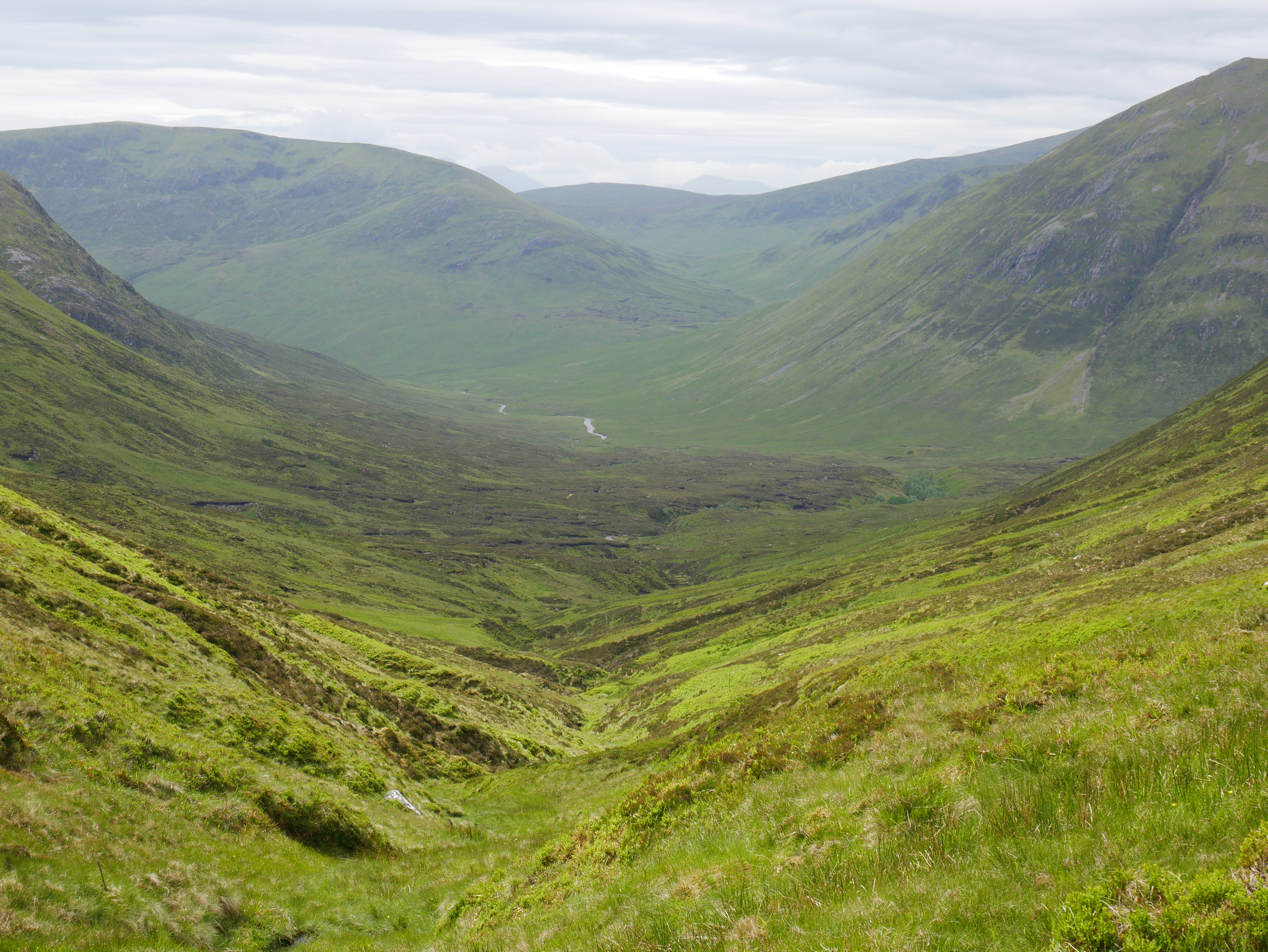
This photo was taken from Wade’s road between Fort Augustus and the Corryarrick
pass, and shows Glen Tarff somewhat west of the location of Beinn Laoigh:

The name Beinn Laoigh is Gaelic for ‘the calf’s mountain’; there is a real mountain
in Argyll with this name (usually Anglicised as Ben Lui rather than Loy).

.jpg)